RESEARCH AND SCHOLARSHIP
The Department of Geography and the Environment supports faculty and student research in a wide range of subdisciplines in the areas of environmental science, geography, and the geospatial sciences.
Department faculty receive significant funding to support research programs that provide myriad opportunities for students to engage in faculty-mentored independent research. Learn about their current research projects in ecosystem response to environmental change and human-environment interactions and social-ecological systems.
RESEARCH AREAS
ECOSYSTEM RESPONSE TO ENVIRONMENTAL CHANGE
Coastal wetlands are hot spots for carbon sequestration and elemental cycling that influence water quality, greenhouse gas exchange, and coastal ecosystem resilience. To better understand biogeochemical cycling in coastal ecosystems, the exchange of carbon, nitrogen, phosphorus, and other important elements between marshes, estuaries, and the atmosphere are analyzed. Research has focused on the intrusion of salt-water into tidal freshwater marshes, the exchange of nutrients between sediments and the water-column, and the role of physicochemical stress on the microbial community that may enhance greenhouse gas production and emission from marsh soils. Field work takes place in coastal systems including the Delaware River estuary and Barnegat Bay, New Jersey.
Contact: Dr. Nathaniel Weston
Learn More: Research Website
Many streams in near Villanova’s campus traverse a rural to urban gradient and offer an ideal opportunity to examine the relationship between land use practices and water quality. Research in the Goldsmith Laboratory has focused on determining the sources and fate of contaminants in these systems (including nutrients, sediment, metals, and pharmaceuticals) and devolving practical solutions to ameliorate the associated impacts. Through collaborations with local municipalities and watershed conservation organizations, such as the Lower Merion Conservancy and the Guardians of the Brandywine, students are able to ask questions of environmental significance while gaining real-world problem-solving experience.
Contact: Dr. Steven Goldsmith
Learn More: Research Website
Marine environments and the organisms that live in them are impacted by various natural and human-caused stressors, including increased temperature, sedimentation, and pollution. In the Rodrigues Laboratory, research focuses on understanding the impacts of these environmental stressors on marine systems. Students can investigate questions that fit this theme along the northeast coastline and/or in controlled tank experiments at Villanova University.
Contact: Dr. Lisa Rodrigues
Rivers transport excess nutrients, sediments, and other pollutants from land to the coast causing both acute and chronic stress to coral reef ecosystems. Although these conduits of delivery are well understood, establishing riverine pollutant thresholds that directly impact coral reef health has remained elusive. To address this problem, dry- and wet-season analyses of river pollutants and associated measurements in nearshore coral reef health in the Guánica region of Puerto Rico are being conducted. In particular, the project seeks to (1) quantify total maximum daily load values for each pollutant throughout the system to discern the threshold for acute stress on coral health; (2) identify point source impacts and mitigation success of existing riparian buffers; and (3) identify the timing of land use thresholds that triggered chronic stress in the past. These efforts are designed to support effective watershed management and healthy coral reef ecosystems. This study is funded by the National Fish and Wildlife Foundation.
Contact: Dr. Lisa Rodrigues and Dr. Steven Goldsmith
Learn More: Research Website
Tidal marshes are productive ecosystems that provide key services to society such as carbon sequestration, storm surge buffering, and water-quality mitigation. The long-term stability of coastal wetlands is explained by interactions among sea level, plant growth, sediment supply, and wetland accretion, but current stability is being threatened by land use change and accelerating rates of sea-level rise. The goals of this study are (1) to understand how past and current land use in watersheds that drain the east coast of the United States has altered sediment concentrations in rivers; (2) to determine how changes in sediment supply influence sediment accretion rates in coastal wetlands; and (3) to project future wetland vulnerability along the east coast under various scenarios of sea level rise and sediment supply. The project is funded by the National Science Foundation.
Contact: Dr. Nathaniel Weston
Learn More: Research Website
As the climate changes, forests adapt. Research in our group studies the spatial patterns and trends in forested ecosystems, especially in the face of a changing climate, using GIS, drones, statistics, and field work to map and model these processes. Broadly, we aim to understand how changes in forests over space and time might impact biodiversity loss, ecological processes, and ecosystem services so that we can better inform forest conservation, restoration and management into the future. Partnering with local organizations such as The American Chestnut Foundation, Martha's Community Farm, and Natural Lands, we aim to use geospatial tools to promote sustainable care and use of our forests.
Contact: Dr. Jennifer Santoro
Coastal hazards such as sea-level rise, earthquakes, tsunamis, and tropical cyclones can have immediate and long-term impacts on communities and the environment. Therefore, exploring coastal systems for evidence of past events is critical for understanding hazards and predicting future risk. Coastal wetlands are uniquely suited for such research questions because they preserve evidence of past events as changes in the sedimentary record, which can span hundreds and thousands of years into the past. Research is focused on using biogeochemical observations to reconstruct a history of past hazards in coastal wetlands. Students have the opportunity to utilize field and laboratory work to explore questions related to this theme.
Contact: Dr. Isabel Hong
More Information: Research website
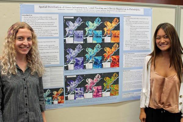
Defining landscape structure and key relationships between landscape structure and function is challenging in urban areas characterized by patchy spatial patterns. To trace the spatial and temporal patterns of urban landscape structures, compare patterns across cities, or inform urban design principles, we need to classify the landscape in a way that captures context and landscape heterogeneity, while being broadly applied across different cities or landscape variations within a city. This project is focused on the development of urban landscape classifications and the relationship among urban structure, environmental indicators, and ecological function. Students interested in this research will develop GIS and remote sensing data and models for analysis of urban structure, environmental and ecological indicators, and statistical modeling of the relationship among them. Current case studies include NYC and Philadelphia in the United States and Berlin and Leipzig in Germany.
Contact: Dr. Peleg Kremer
HUMAN-ENVIRONMENT INTERACTIONS AND SOCIAL-ECOLOGICAL SYSTEMS
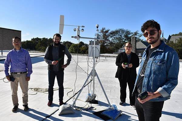
Air pollution is one of the leading causes of global deaths. High levels of particulate matter (PM) exposures are one of the main environmental health concerns. Several adverse effects have been related to exposure to high levels of PM. Our research group is interested in measuring exposures to PM and other air pollutants such as ozone, nitrogen oxides, sulfur dioxide, and ammonia in indoor and outdoor environments. Our group has several types of portable and stationary air quality monitors to measure air pollution. Our research group has applied stationary air pollution monitors, mobile monitoring technique, passive sampling technique to measure air pollution in the Philadelphia region. Additionally, we have measured air pollution exposures in various microenvironments including underground subways. Research works from this lab have been funded by the National Science Foundation (NSF), the National Institutes of Health (NIH), and the United States Environmental Protection Agency (US EPA). Students will have the opportunity to develop their own research questions in these areas, participate in field and laboratory works, and apply advanced statistical tools and GIS tools in their studies.
Contact: Dr. Kabindra M. Shakya
More Information: Research Website
Over the last half-century, the frequency and magnitude of environmental disasters and losses have been increasing due to a combination of natural and societal factors. Recent weather-related disasters such as Hurricane Sandy and the 2011 Joplin, MO tornado are reminders of the devastating consequences often associated with some of nature’s most intense phenomena. Modern climate modeling and Geographic Information Science (GIScience) techniques have promoted spatiotemporal examinations of changes in environmental hazard impacts on society. The Northeast U.S., specifically the Boston-New York-Philadelphia-Washington D.C. I-95 corridor, is subject to a number of atmospheric and environmental hazards such as tropical storms, inland flooding, tornadoes, winter storms, heat waves, erosion, etc. Students investigating questions related to these research themes will be provided the opportunity to share their findings with local and regional stakeholders, decision makers, and the public.
Contact:
More Information: Lab Website
Environmental pollution and climate change have disproportionate impacts on the minority population and socio-economically disadvantaged groups. Previous research has shown that pollutant levels such as atmospheric particulate levels and soil heavy metal concentrations are greater in the areas with minority population. Foremost, it is important to monitor environmental pollutant levels in vulnerable communities to assess if there is disproportionate burden in environmental justice communities. Past work from our lab includes assessing air pollution exposure around different locations in Philadelphia and assessing heavy metal contamination in soils of community gardens across the Philadelphia region and Pittsburgh. Students interested in this project can design their research project to either collect their primary data on pollutant exposures (air and soil pollution) in environmental justice communities or analyze existing pollution data with the application of GIS tools.
Contact: Dr. Kabindra M. Shakya
More Information: Research Website
The global wildlife trade is an expansive and growing industry that touches nearly every branch of the tree of life. Wildlife trade is a known threat to global biodiversity, threatening species directly through overexploitation and indirectly by facilitating the spread of invasive species and zoonotic pathogens. At the same time, wildlife trade can also be an essential source of human livelihood and food security, underly important cultural and community traditions, and foster connections between people and nature. Our research group seeks to understand the biological and socioeconomic conditions that can result in wildlife trade becoming unsustainable. Students will have the opportunity to explore this topic using both field-based and quantitative methods, such as surveying exotic pet markets in Pennsylvania, leveraging “big” wildlife trade data, and developing bioeconomic models of wildlife harvest.
Contact: Dr. Ryan Almeida
More information: Research Website
As urbanization expands, city planners and policymakers need to consider how ecological resources can be strategically developed and sustainably managed to meet the needs of urban populations. The ecosystem services (ES) approach provides a useful framework for assessing the status quo, setting goals, identifying benchmarks and prioritizing approaches to improving ecological functioning for urban sustainability and resilience. Understanding the dynamics of urban ecosystem services is a necessary requirement for adequate planning, management, and governance of urban green infrastructure. Mapping, modeling, and valuing urban ecosystem services are important for integrating the ecosystem services concept in urban planning and decision-making. Research in this area is focused on the development of models and tools for the spatially explicit quantification of multiple ecosystem services in urban areas. Students interested in this area will engage in theoretical, conceptual and empirical investigations of urban ecosystem services and the comparative analysis of supply, demand and spatial distribution of urban ecosystem services.
Contact: Dr. Peleg Kremer
Contemporary events suggest that there is a strong correlation between environmental change and conflict because stress induced by climate change, environmental degradation, and demographic factors intensifies latent ethnic rifts and extant political instability. Recent events also suggest that this trend will persist because climate change will continue to challenge stability in countries with inherently weak governance. Since the end of the Cold War, linkages between the environment, regional stability, and conflict—that is, environmental security—have become an important paradigm in security planning and policy. Consequently, the concept of environmental security has emerged as one basis for understanding conflict and global security. This project is a quantitative analysis of processes (e.g., climate change) and factors (e.g., demographics) that occur at the nexus of the human and natural landscape and represents an interdisciplinary blend of policy, geography, and environmental science. Quantitative research on the causes and implications of environmentally triggered conflict are important because conflicts with an environmental component have increased pressure on the West and U.N. to commit resources to stability and disaster relief efforts. Contemporary examples in Chiapas, Darfur, Rwanda, Ethiopia, East Timor, and Haiti indicate that a nexus of environmental stress and instability is a modern reality and that the specter of climate change and resource scarcity may prompt a surge in violent conflict in the future. Although these case studies offer compelling examples, they also underscore the principal weakness of the model, which is a lack of predictive capacity. That is, we have no overarching sense of which environmental scenarios will lead to conflict in the future. For this reason, we are developing a vulnerability index to quantitatively evaluate the relative stability of states and regions, and thus provide a quantifiable index to determine states at risk and potentially predict the tipping point at which a country or region devolves into environmental–triggered conflict.
Contact: Dr. Francis A. Galgano
Extraction of natural gas from the Marcellus Shale through horizontal drilling and hydraulic fracturing (“fracking”) has raised significant environmental concerns, while providing economic benefits and a substantial source of domestic energy. Little data exist on the impacts of drilling and fracking on surface stream systems. To address these knowledge gaps, 30+ stream sites in the Susquehanna River basin in northeastern Pennsylvania have been sampled each summer since 2013. A suite of geochemical parameters, including major ions, trace elements, heavy metals, methane, radium, and nutrients will help evaluate changes in water quality over time and in relation to the natural gas extraction activities in each watershed. The goal of this research is to understand what impacts, if any, natural gas extraction activities have on surface waters to inform management and regulatory decisions. This project is funded by a Pennsylvania Sea Grant.
Contacts: Dr. Steven Goldsmith and Dr. Nathaniel Weston
Learn More: Research Website